Introduction

When I moved to Seattle from the east coast about 25 years ago, I started to explore the city and the surrounding area by bike; first, commuting to work and then adding fitness rides to my commuting trips. What I found were challenging routes that gave me a great workout but also some beautiful scenery, great parks, spectacular views plus interesting restaurants, cafes, bistros and bakeries along the way to stop for a snack or a cold drink. I think that by traveling by bike, at my own pace on quite streets and trails, through neighborhoods and parks, I have seen the Seattle area in a way I would not have experienced otherwise. I want to share with you the rides that have given me such a unique insight into our city and surrounding area. Whether you are new to town or a native, I hope you’ll find something to enjoy in these rides that have become my favorites.

This blog describes several loop bicycle rides in and around the Seattle metropolitan area with rides for every level of cyclist. Many of the loop rides can be combined or can be done as a shorter “out and back ride”. Each loop described on this blog includes a convenient start/end point that offers ample parking for those transporting their bicycle. Any loop can be done in either direction.

Tuesday, February 19, 2013

Mercer Island - May Valley - Issaquah

This 55 Mile loop starts at Seward Park and heads north over the I-90 Bridge to Mercer Island. At Lid Park take a right onto West Mercer Way for a counter clockwise ride through the rolling, rural terrain. This 10 mile stretch of Mercer Island has no stop signs or lights so is a great training segment. Cross over I-90 and over the East Channel bridge to 118th Ave SE in Bellevue. Merge on to the bike trail which parallels I-405.  Ascend Lake Washington Blvd over I-405 and descend back on Lk WA Blvd to NE 44th St / Lincoln Ave NE for the ascent to Coal Creek Pkwy and SE May Valley Road. Enjoy the horse farms and  rural scenery of May Valley before turning onto Issaquah-Hobart Rd toward Issaquah. Parallel I-90 on Newport Way through Factoria back to Mercer Island and Seward Park


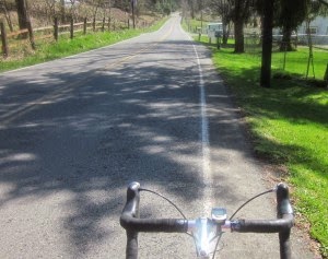
Riding down May Valley Road

For details on this route such as map, ride stats, full directions and elevation profile:visit RideWithGPS

Friday, February 1, 2013

Snohomish - Granite Falls - Arlington

This 46 mile ride was sponsored by Cascade Bicycle Club starting at the Pilchuck trail head on the Centennial Trail just north of Snohomish. After a  3 mile warm up on the Centennial Trail the ride travels through the rural countryside to Jordan Bridge Park. After crossing this foot bridge over the south fork of the Stillaguamish River there is a short (0.4 mile) section that has a steep 9% average grade as it ascends to Burns Road before the descent into Arlington. After lunch in Arlington (try the Blue Bird Cafe at 308 N Olympic) return to Snohomish via the Centennial Trail.


For details on this route such as map, ride stats, full directions and elevation profile:visit RideWithGPS


Jordan Bridge

Sunday, January 20, 2013

Magnolia - Discovery Park Loop

This 27 mile  ride starts at Gas Works Park and heads west on the Burke-Gilman Trail then over the Fremont Bridge. Continue west on Nickerson (or alternately on S Ship Canal Trail) to Fisherman's Terminal. Detour to Cafe Appassionato at 4001 21st Ave W for a quick snack or great cup of coffee. Pass Commodore Park then ascend 40th Ave to Discovery Park. Ride through the park to Magnolia Blvd with views of Puget Sound and Olympic Mts. Cut off Thorndyke onto Plymouth St to further explore Magnolia and its eastern ridge. The ride then takes you through the flats to Smith Cove Park and then onto Centennial, Myrtle Edwards and the Sculpture Parks along Elliott Bay. Stop at Uptown Espresso at Alaskan Way & Broad St at end of Elliott Bay Bike Trail for cookie and coffee. Return to Gas Works Park via Elliott Bay Bike Trail, S Ship Canal Trail, the Fremont Bridge and the Burke-Gilman Trail.

For details on this route such as map, ride stats, full directions and elevation profile:visit RideWithGPS

Downtown Seattle from Magnolia Park

Saturday, December 1, 2012

Magnuson Park - West Seattle - Discovery Park

55 mile loop ride from Magnuson Park heading south to Lake Washington Blvd. Turn west through I90 Tunnel/Trail to Dearborn; skirt the International District on SODO trail to W Spokane St Bridge. Climb to High Point (35th Ave SW & SW Myrtle St is highest point in Seattle at 520 feet) via Avalon Way then onto Marine View Drive past Lincoln Park and onto the Beach Dr and the Alki Trail. Head back through the Seattle Waterfront on Alaskan Way. Take one more loop (adds 5-6 miles) through Discovery Park to Fisherman's Terminal and the S Ship Canal Trail/BGT or head directly back to Magnuson Park via Dravos/15th Ave/Nickerson/Fremont Bridge/BGT.


For more details on this ride visit RIDEWithGPS for a map, ride stats, full directions and elevation profile:
GO to Ride Details

View of downtown Seattle from High Point Neighborhood


Monday, November 5, 2012

Magnuson Park-Wedgwood-Green Lake

24 Mile Ride around View Ridge-Wedgwood-Meadowbrook-Green Lake


This ride starts from Magnuson Park and includes the recently completed 39th Ave NE neighborhood greenway to View Ridge. This new greenway was funded by Seattle Children’s Livable Street Program. The ride continues to the Sand Point Country Club with nice views of Lake Washington and the Cascade Mts. From there it explores the neighborhoods of Wedgwood and Meadowbrook then onto Green Lake with a return on the Burke-Gilman Trail through UW to Magnuson Park.

For more details on this ride visit RIDEWithGPS for a map, ride stats, full directions and elevation profile:

Go to Ride Details


Thursday, October 18, 2012

Gas Works Park-Volunteer Park

12 Mile Loop Ride to Volunteer Park

Ride Starts at Gas Works Park and crosses University Bridge to Interlaken Park via 11th Ave and its steep 15% grade to Bagley Viewpoint (Note: continue on Boyer to E Lynn then right on Delmar Dr for alternate route to avoid the 11th Ave climb). Ascend through Interlaken Park to N Capitol Hill and Volunteer Park. Descend back down to S Lake Union hugging the shore line to return to Gas Works Park via the Fremont Bridge.

For more details on this ride visit RIDEWithGPS for a map, ride stats, full directions and elevation profile:

Go to Ride Details

Black Sun Sculpture - Volunteer Park

Thursday, October 11, 2012

Snohomish River Valley

40 mile rural ride around Snohomish River Valley

Start at Riverside Park in Everett and head southeast on Lowell Snohomish River Road which runs parallel to Snohomish River. Visit the historic area of town on 1st Street; try a couple of the many food stops such as Snohomish Bakery & Cafe (on left, offering great bake goods as well as sandwiches and pizza) or the Snohomish Pie Co (sandwiches, soup and GREAT pie).

Leave Snohomish on Old Snohomish Monroe Road. Continue through Monroe on W Main Street to S Lewis St and onto Tualco Road. Cross the Snoqualmie River and head north on High Bridge Road. Turn onto Welch Road to ascend to the high horse country around Lost Lake and Echo Lake. Descend back to Snohomish River Valley via Elliot, Connelly and Broadway.

Return to Riverside Park on the west side of the Snohomish River Valley on Lowell Larimer Road which has a slight elevation and offers some nice views of the valley and the Cascade Mountains (on a nice day).

For more details on this ride visit RIDEWithGPS for a map, ride stats, full directions and elevation profile:
Snohomish River Valley Ride Information

View of Snohomish River from Riverside Park, Everett